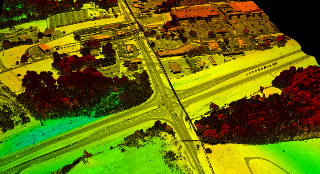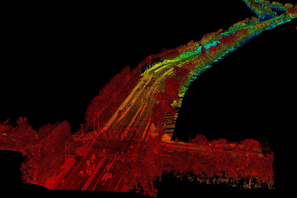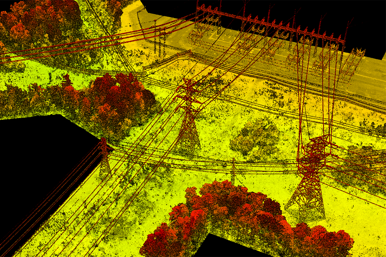
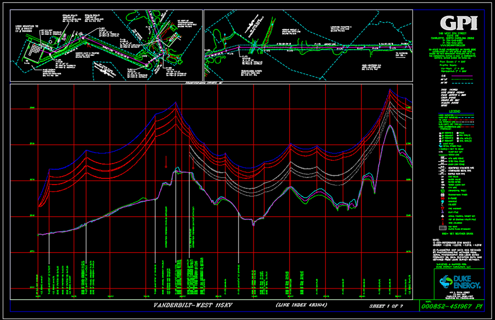
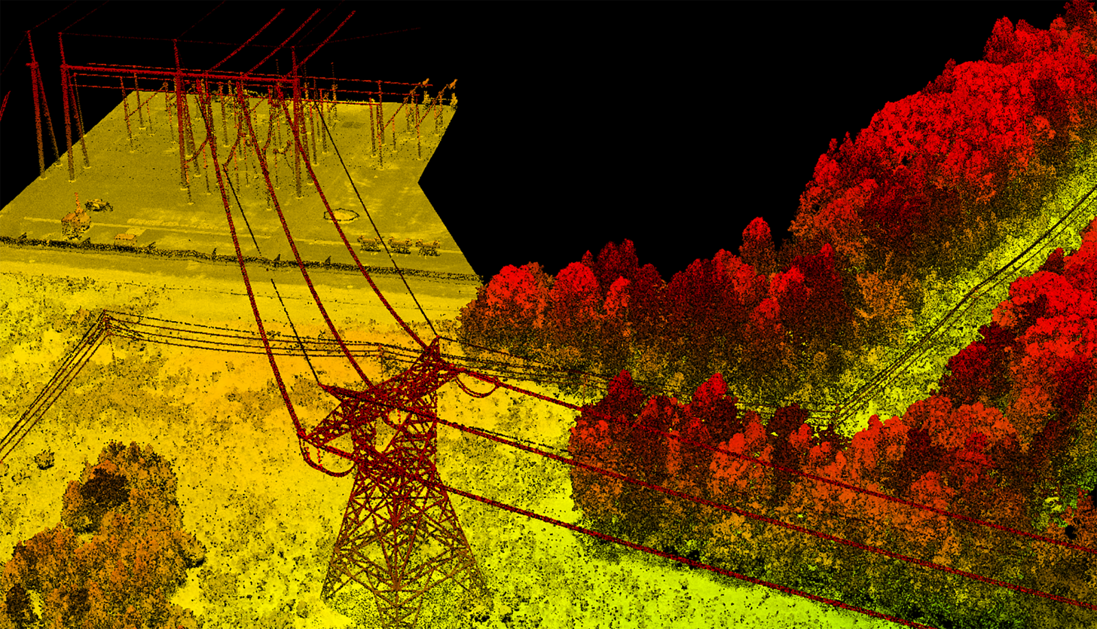
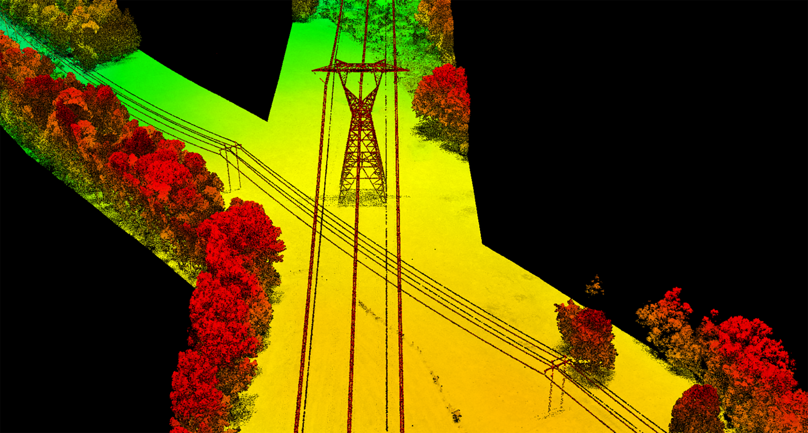
Operating in seven Southeast and Midwest states, Duke Energy needs a range of geospatial services for its enterprise activities. These services include surveys, mapping, and data collection for various purposes such as control surveys, land and easement boundary surveys, topographic surveys, vegetation surveys, and more.
In 2020, GPI Geospatial and Duke Energy entered into a 3-year agreement for these services, with GPI Geospatial successfully completing over 300 tasks totaling over $3 million to date. GPI Geospatial’s comprehensive geospatial services range from construction staking and boundary surveys to high density aerial lidar and photogrammetry projects to support PLS-CADD modeling. GPI Geospatial is one of few firms that Duke has approved to perform aerial surveying services for their assets; GPI Geospatial regularly acquires aerial lidar and imagery data for other Duke Energy contractors for their projects.
Project Highlights
-
Owner/ClientDuke Energy
-
LocationMulti-State Contract
-
ServicesAerial LiDAR
Boundary Survey
Construction Staking
Photogrammetry


Ranked in the Top 100 Professional Services Firms
The ENR (Engineering News-Record) Top 100 Professional Services Firms is an annual ranking of the top firms in the professional services sector within the construction and engineering industry. Being recognized as an ENR Top 100 Professional Service firm signifies a company’s excellence, credibility, and competitiveness within the construction and engineering industry.