Montgomery County, the most populous county in Maryland, is located near Washington, D.C., as part of the Washington metropolitan area. It houses many U.S. government offices, scientific research centers, and business campuses, making it a vital business and research hub. The county boasts the third-largest biotechnology cluster in the U.S. and many Federal agencies, including the FDA, NIH, USUHS, and Walter Reed Army Institute of Research, are based in the county. Additionally, major companies such as Lockheed Martin, Marriott International, and GEICO have headquarters there.
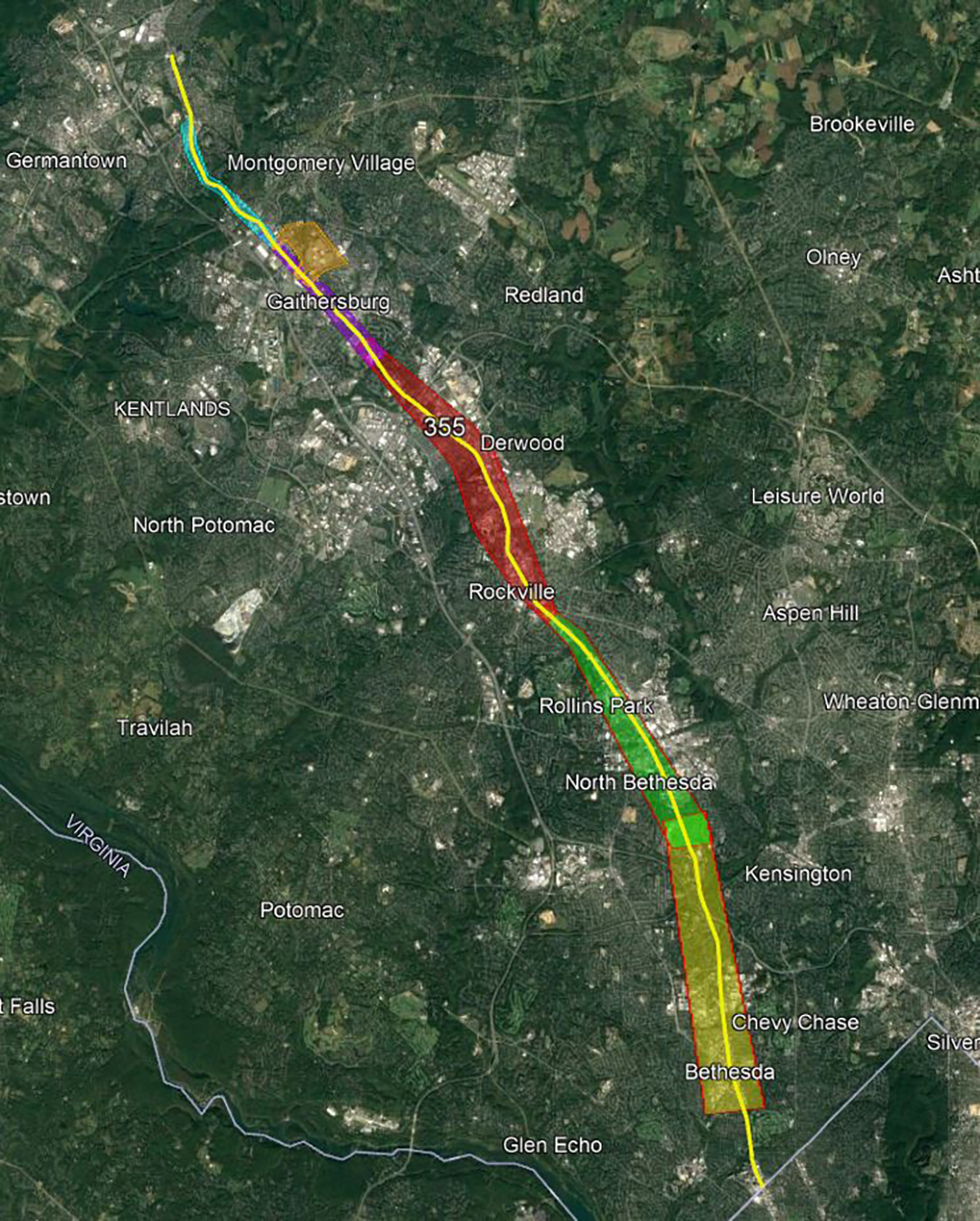
The Montgomery County Planning Board, part of the Maryland-National Capital Park and Planning Commission, is committed to enhancing community life by addressing key issues like growth, transportation, environmental protection, agriculture, historical preservation, and forest conservation. Through its 2013 Countywide Transit Corridors Functional Master Plan, the board aims to improve transit opportunities to support economic development and mobility goals sustainably. The plan suggests changes to the transportation network, focusing on densely developed areas, redevelopment zones, and new dense development areas. Notably, the plan includes the MD 355 Flash BRT service, enhancing bus service along MD 355 (Wisconsin Avenue/Rockville Pike/Frederick Road) with dedicated lanes, supplying fast and reliable transit to this bustling corridor. The project fosters new connections and supports growth and redevelopment in key activity centers.
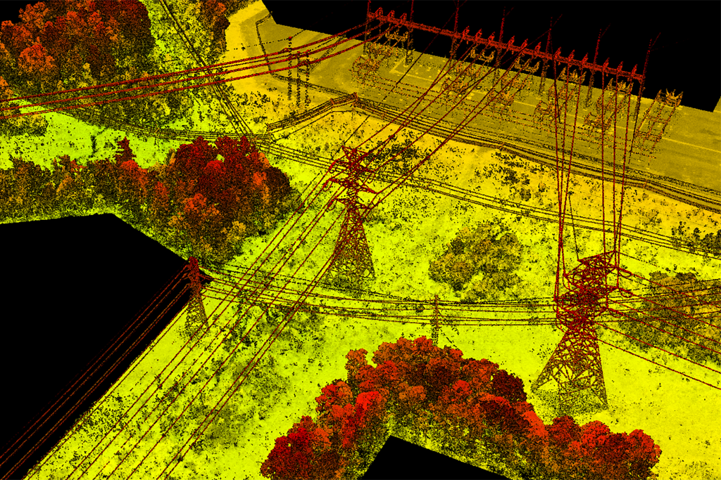
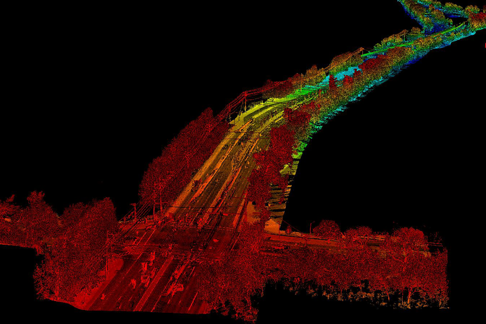
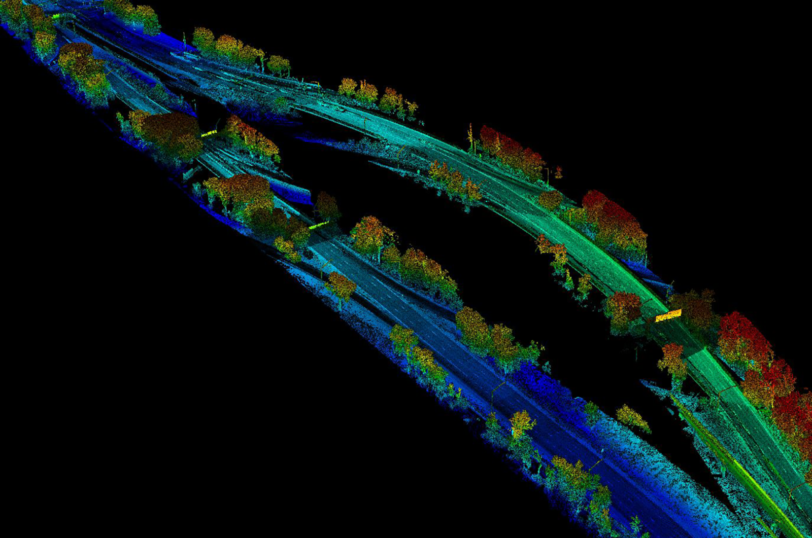
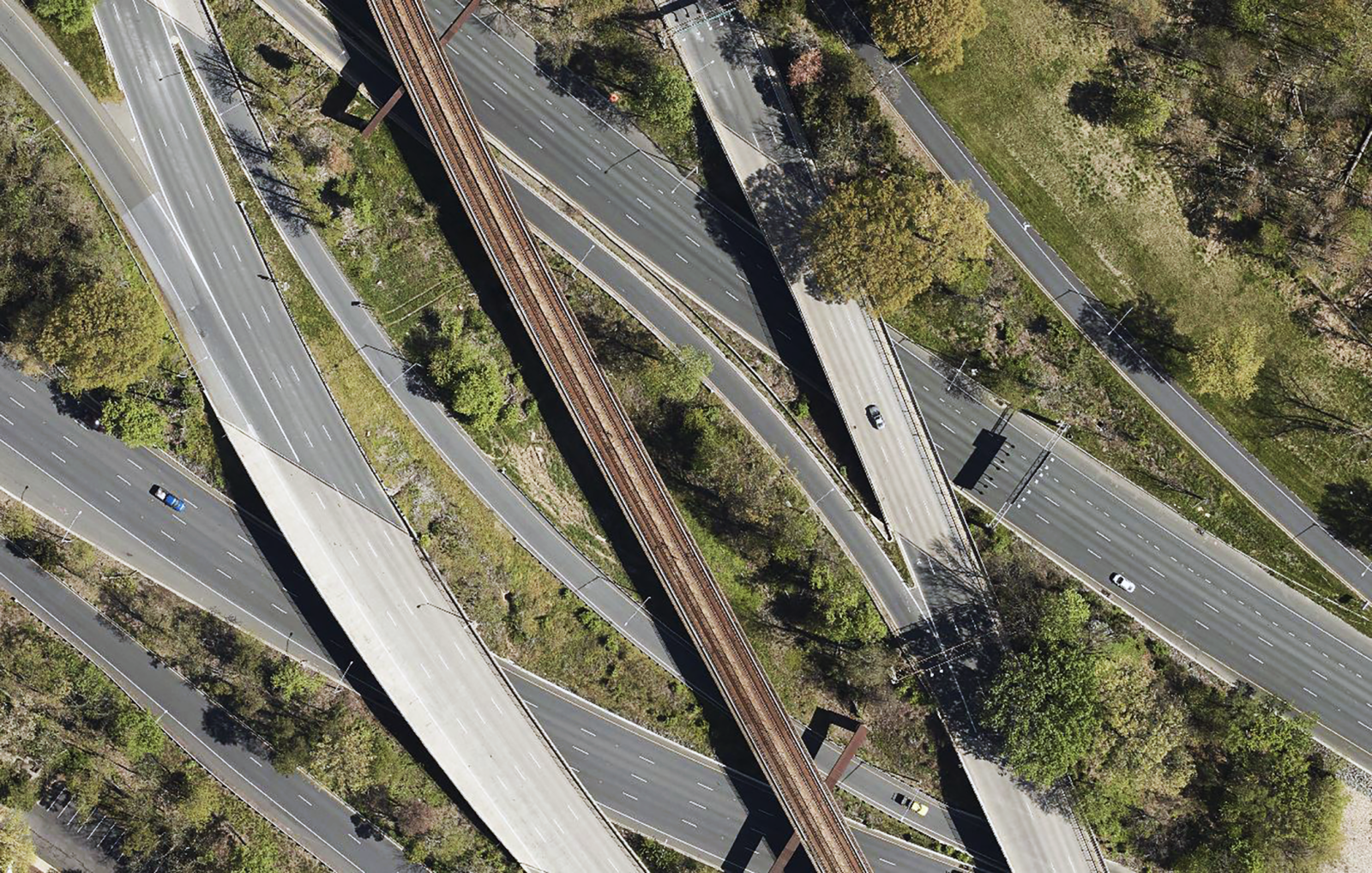
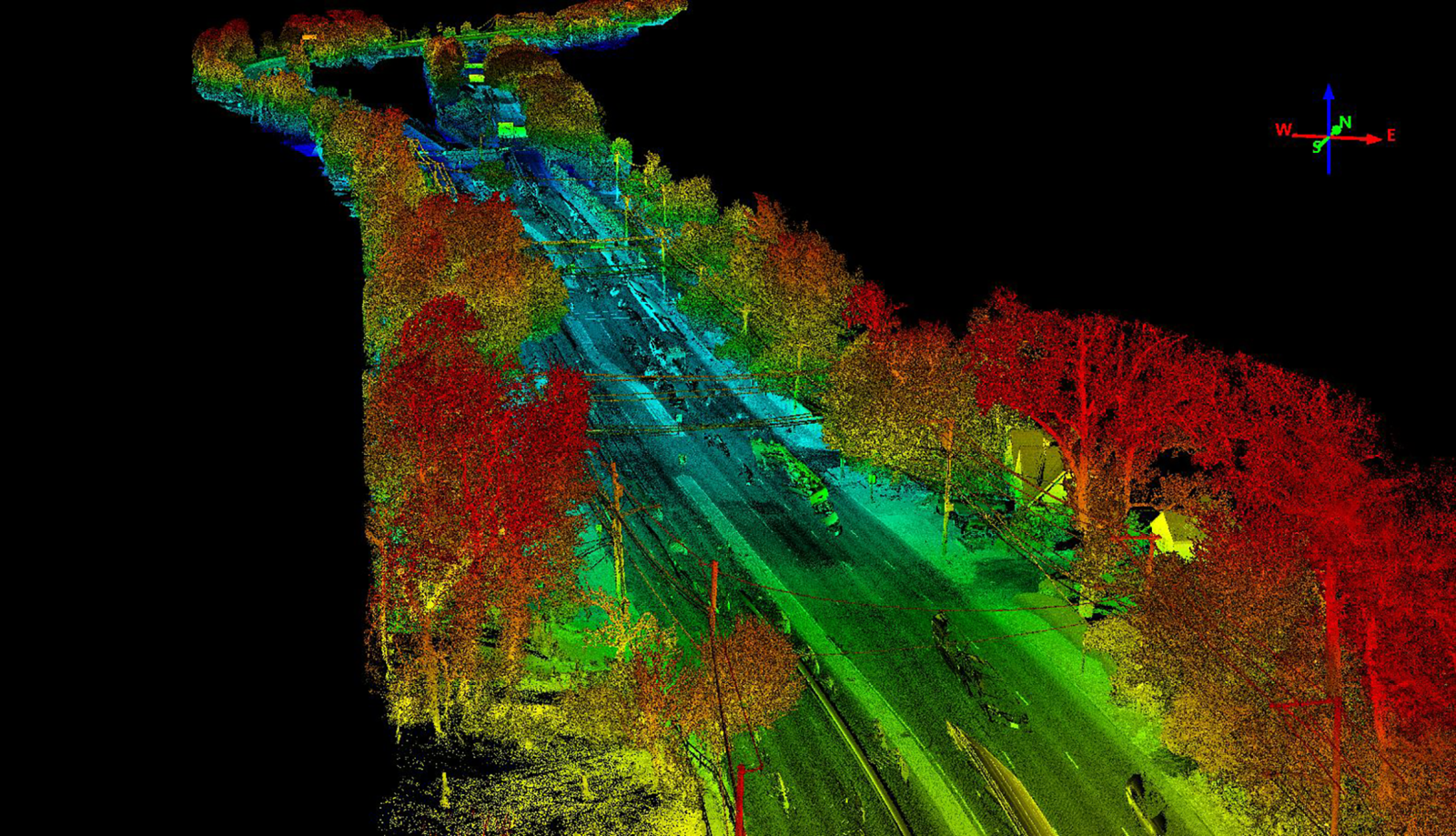
During the design of the BRT routes, establishing surveying control and obtaining design-grade survey mapping were critical parts of the process. Under a joint venture contract, GPI Geospatial played a key role by using its mobile mapping system to collect ground-based lidar. Covering approximately 21.7 miles of existing urban roadway along a busy commercialized highway in the county’s main business districts, GPI Geospatial’s survey crews set and positioned over 300 mobile and aerial targets using RTK GNSS positioning. They established more than 20 primary control stations with NGS OPUS positioning services and CORS stations, determining elevations through precise digital leveling along the entire corridor. The terrestrial lidar and street level imagery are used for extraction of planimetric and DTM data. The aerial imagery and lidar are being used to develop georeferenced orthophotography and bare earth lidar surface data to augment obscured areas.
Project Highlights
-
Owner/ClientMontgomery County Department of Transportation
-
LocationMontgomery County, MD
-
ServicesAerial Imagery
Aerial LiDAR
Mobile Imagery
Mobile LiDAR

Ranked in the Top 100 Professional Services Firms
The ENR (Engineering News-Record) Top 100 Professional Services Firms is an annual ranking of the top firms in the professional services sector within the construction and engineering industry. Being recognized as an ENR Top 100 Professional Service firm signifies a company’s excellence, credibility, and competitiveness within the construction and engineering industry.