The historic city of Salisbury, MD, is the county seat of Wicomico County and the largest city on Maryland’s Eastern Shore. The city has deep historical roots, originating as a small colonial outpost established in 1732. Today, Salisbury has evolved into a diverse urban center, attracting a range of businesses alongside county, state, and federal government offices. The city hosts various events celebrating local culture and the arts and reflecting its rich heritage. Salisbury features a historic park, zoo, shopping mall, and a youth and civic center.
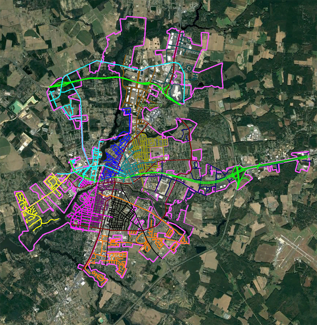
The City of Salisbury has an ambitious capital improvement plan, which is a multiyear strategy outlining maintenance and enhancements for its publicly owned infrastructure. The plan prioritizes various needs, including transportation, stormwater management, parking, and water and sewer systems. It addresses improvement and replacement requirements for public buildings and major equipment across all city departments. As a foundational step for transportation improvements, the city identified the need for a current and accurate pavement condition index and street sign inventory. This initiative aims to capture and classify conditions on all roadways within the municipal limits of the City of Salisbury. As the city’s most recent data was collected in 2013, this program is considered critical for conducting proper analysis and planning for infrastructure maintenance and growth.
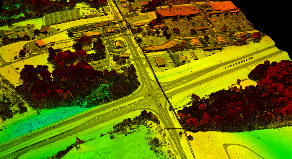
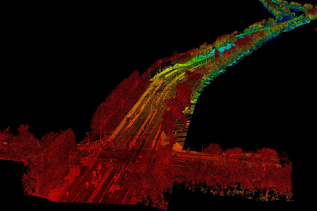
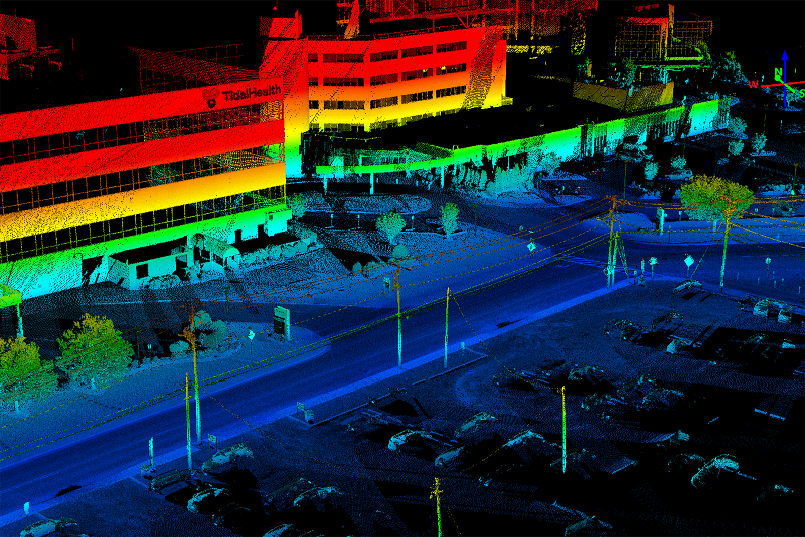
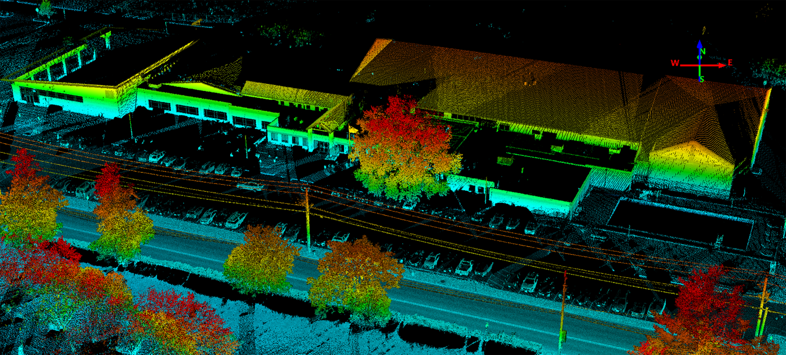
GPI Geospatial gathered precise mobile LiDAR data for approximately 200 miles of roadways in the City of Salisbury. Instead of relying on specific control points, this collection used GNSS control post-processed against a GPS Base station for sub-meter absolute accuracy and centimeter relative accuracy. High-resolution imagery and video were collected simultaneously with the LiDAR data. The imagery, closely calibrated to the LiDAR, was exported for delivery. The georeferenced high-definition video, accompanied by a viewer displaying video and positional information, was also delivered. Another company used the LiDAR surface model, imagery, and video to assess pavement conditions based on ASTM D6433 standards, determining PCI values for each pavement section. The LiDAR and imagery data also extracted sign features along roadways using GPI Geospatial’s proprietary software. Technicians derived geographic positions, dimensions, conditions, clearances, MUTCD codes, and road information for each sign feature. The imagery played a key role in future city infrastructure planning.
Project Highlights
-
Owner/ClientCity of Salisbury, MD
-
LocationSalisbury, MD
-
ServicesMobile Imagery
Mobile LiDAR
Survey

Ranked in the Top 100 Professional Services Firms
The ENR (Engineering News-Record) Top 100 Professional Services Firms is an annual ranking of the top firms in the professional services sector within the construction and engineering industry. Being recognized as an ENR Top 100 Professional Service firm signifies a company’s excellence, credibility, and competitiveness within the construction and engineering industry.